C Location 4
Inserted / Updated : 02.07.2016 / 22.08.2018
Height: 2020m Viewing angle: 180° Viewing direction center of photo: NW
Compare the situation from with that from (<<< select date) Period of time: 2535 days (= 6.95 years)
The
terms of use for these repeat photos can be found
here...
Direct link...
Location 4 is opposite location 1, and the eastern glacier stream flows between location 1 and 4.
2016 - 2017: As expected, nothing much has changed here. To the left of the striking gravel/ice hill, a new 20m high funnel with a small lake in front of it has formed.
C Location 6
Inserted / Updated : 30.08.2017 / 27.06.2020
Height: 2122m Viewing angle: 177° Viewing direction center of photo: SW
Compare the situation from with that from (<<< select date) Period of time: 3265 days (= 8.95 years)
The
terms of use for these repeat photos can be found
here...
Direct link...
This comparative photo shows an overview of the Gamchi glacier.
C Location 6a Inserted: 13.03.2020
Image comparison period: 12.07.2015 - 08.07.2016 Period of time: 362 days (= 0.99 years)
The
terms of use for these repeat photos can be found
here...
Direct link...
This repeat photos shows the formation of an erosion ditch in the glacier forefield of Gamchi glacier. On 12.7.2015 the majority of the water flowed off to the east (to the right in the photo). No erosion ditch was yet visible. On 8.7.2016 (= one year later) the prominent erosion ditch existed already in the same size as in the summer of 2019. Photos showing the size of the erosion ditch with the help of a person can be found on the page with the description of the term 'Erosion ditch'.
C Location 15
Inserted / Updated : 24.09.2017 / 07.10.2024
Height: 2068m Viewing angle: 220° Viewing direction center of photo: NW
Compare the situation from with that from (<<< select date) Period of time: 2586 days (= 7.08 years)
The
terms of use for these repeat photos can be found
here...
Direct link...
18.07.2024: The last panoramic photo taken from this location. During the night of 1./2. August 2024, an erosion gully opened up during a heavy rainfall event. The boulder from location 15 fell into the erosion gully.
In June 2017 we observed for the first time a newly created lake, which is surrounded by ice on the valley side. By the beginning of September 2017 the lake has grown in size and probably also in depth.
C Location 7
Inserted / Updated : 05.07.2019 / 01.10.2024
Height: 2153m
Compare the situation from with that from (<<< select date) Period of time: 2983 days (= 8.17 years)
The
terms of use for these repeat photos can be found
here...
Direct link...
This comparison shows the formation and development of the proglacial lake, which was formed in late 2016 or early 2017 and emptied in September 2019. In the following years, an impressive erosion trench has formed. View from eastern lateral moraine.
C Location 14a
Inserted / Updated : 29.08.2019 / 02.06.2025
Height: 2075m
Compare the situation from with that from (<<< select date) Period of time: 2638 days (= 7.23 years)
The
terms of use for these repeat photos can be found
here...
Direct link...
This comparison shows the origin and development of the proglacial lake, which originated at the end of 2016 or beginning of 2017. Location: Mountain path from the eastern lateral moraine down to the glacier.
C Location 14
Inserted / Updated : 17.10.2019 / 02.06.2025
Height: 2075m Viewing angle: 200° Viewing direction center of photo: SW (222°)
Compare the situation from with that from (<<< select date) Period of time: 3989 days (= 10.93 years)
The
terms of use for these repeat photos can be found
here...
Direct link...
On the photo from 2013 you can see the iron ladder over which the mountain path led at that time.
On the photo from 2019 you can see the remains of the lake, which was formed in June 2017 and leaked in September 2019.
C Location 21
Inserted / Updated : 13.12.2019 / 17.02.2025
Height: 2052m Viewing angle: 100° Viewing direction center of photo: S (185°)
Compare the situation from with that from (<<< select date) Period of time: 1851 days (= 5.07 years)
The
terms of use for these repeat photos can be found
here...
Direct link...
14.08.2019: Behind the ice was was the glacial lake at that time. The clear transition from the glacier ice to the underlying moraine material is clearly visible on this photo.
This before/after photo comparison shows the evolution of the ice wall during 12 months. During these 12 months the small glacial lake behind has emptied and a part of the ice wall has collapsed.
C Location 22
Inserted / Updated : 22.06.2022 / 16.12.2024
Height: 2055m Viewing angle: 148° Viewing direction center of photo: NW (314°)
Compare the situation from with that from (<<< select date) Period of time: 1484 days (= 4.07 years)
The
terms of use for these repeat photos can be found
here...
Direct link...
These repeat photos show the melting of the ice bar that had dammed the glacial lake. Further how the terrain changes after the melting of the ice.
The surroundings of the tripod location are still quite unstable. Presumably, the shooting location itself has also sunk a bit. A hundred percent accuracy of fit is therefore hardly feasible without cheating.
C Location 23
Inserted / Updated : 01.04.2025 / 09.04.2025
This photo comparison shows the dynamics that occur when retreating glacier ice uncovers terrain.
Compare the situation from with that from (<<< select date) Period of time: 1538 days (= 4.21 years)
The
terms of use for these repeat photos can be found
here...
Direct link...
08.09.2024: On the right, the beginning of the erosion trench (= middle erosion trench) can be seen, which probably originated during a heavy rainfall event in the night of 1./2. August 2024. See also the following photo comparison.
C Middle erosion trench Inserted: 18.09.2024
The erosion trench probably formed during a heavy rainfall event on the night of 1./2. August 2024.
Image comparison period: 18.07.2024 - 07.09.2024 Period of time: 51 days (= 0.14 years)
The
terms of use for these repeat photos can be found
here...
Direct link...
Detail of the before/after photo comparison above.
Der Fotovergleich zeigt auf Höhe des mittleren The photo comparison shows a width of around 400m at the height of the middle erosion trench. The boulder from site 15 was located at the yellow dot. See also from about the middle of the report
7.9.2024.
C Location 5
Inserted / Updated : 20.09.2017 / 05.07.2020
Height: 2002m Viewing angle: 290° Viewing direction center of photo: S
Compare the situation from with that from (<<< select date) Period of time: 1808 days (= 4.95 years)
The
terms of use for these repeat photos can be found
here...
Direct link...
This comparison shows the situation in the western part of the Gamchi glacier. In July 2015 we discovered a flat, newly created glacial lake in front of a large portal. A year later the lake did not exist any more and until September 2017 a lot of ice melted away.
C Location 8
Inserted: 21.06.2017
Height: 2063m Viewing angle: 190° Viewing direction center of photo: SE
Compare the situation from with that from (<<< select date) Period of time: 789 days (= 2.16 years)
The
terms of use for these repeat photos can be found
here...
Direct link...
Location 8 could not be entered in 2014 for safety reasons and was still covered by ice until 2012. The upper body of a person can be seen on the picture from 19 July 2017 at the left edge of the picture.
C Location 8a Inserted: 10.07.2021
Diese Wiederholungsfotos zeigen, wie unterschiedlich die Schneelage Anfang Sommer sein kann.
Height: 2063m Viewing angle: 330°
Image comparison period: 23.06.2020 - 02.07.2021 Period of time: 374 days (= 1.02 years)
The
terms of use for these repeat photos can be found
here...
Direct link...
23.06.2020: A lot of snow has already melted. The glacier ice is exposed to the sun's rays and heat and melts.
02.07.2021: There is still a lot of snow. The glacier ice is quite well protected from the sun's rays and heat until the snow has melted.
Lots of snow at the beginning of summer does not necessarily mean that the glacier will have increased in mass and/or length by the end of summer.
These repeat photos show how different snow conditions can be in early summer.
C Location 24 Inserted: 04.07.2022
These repeat photos show the eastern erosion trench in cross-section. The depth of the erosion trench is about 8m (estimate).
Height: 1997m
Image comparison period: 23.06.2020 - 17.06.2022 Period of time: 724 days (= 1.98 years)
The
terms of use for these repeat photos can be found
here...
Direct link...
17.06.2022: Since June 2020, stones and debris have come loose from the steep side walls of the erosion ditch. This material has been deposited at the foot of the side walls. The previously almost U-shaped cross-section of the trench is moving towards a V-shape.
C Location 1
: Comparison 1
Height: 2052m Viewing angle: 335° Viewing direction center of photo: SW
The cross section of the tunnel on the left has strongly enlarged while its length is shrink by the collapse of the rear part to about half. Possibly already in this summer the meanwhile thin cover of this tunnel will also break.
The span of the portal (right) has decreased. The funnel above the portal is much more powerful than a year ago.
The scree slope, from which the photographs were taken, has also changed since July 2010. It was therefore not easy to find exactly the same point for shooting.
Between July 2011 and July 2012, the left bow of ice has collapsed.
Compare the situation from with that from (<<< select date) Period of time: 1455 days (= 3.99 years)
The
terms of use for these repeat photos can be found
here...
Direct link...
Height: 2050m Viewing angle: 348° Viewing direction center of photo: SW
Image comparison period: 16.07.2011 - 18.07.2012 Period of time: 368 days (= 1.01 years)
The
terms of use for these repeat photos can be found
here...
Direct link...
The Shooting place of both panoramic photos does not match 100%. The massive changes should still be visible.
Height: 2050m Viewing angle: 311° Viewing direction center of photo: SW
Image comparison period: 18.07.2012 - 27.06.2014 Period of time: 709 days (= 1.94 years)
The
terms of use for these repeat photos can be found
here...
Direct link...
Height: 1970m Viewing angle: 100° Viewing direction center of photo: SW
Image comparison period: 16.07.2011 - 18.07.2012 Period of time: 368 days (= 1.01 years)
The
terms of use for these repeat photos can be found
here...
Direct link...
Within a year, the mighty arch of ice has collapsed.
O Overview photo Gamchi glacier Photo from 19.06.2017
Horizontal distance point 8 -> point 5: approx. 435m
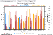
M Current meteo and climatic data for the Gamchi glacier.
The meteorological/climate data from the MeteoSwiss measuring stations closest to the Gamchi glacier have been available since December 2023. You can call up the daily and monthly values for temperature (incl. min/max values), precipitation and sunshine duration, a comparison with the climate standard values and exceptional weather events. Links to the nearest snow depth measuring stations on the Gamchi glacier round off the offer.