C Location 1
Updated : 11.11.2024
Height: 2411m Viewing angle: 120° Viewing direction center of photo: NE
Compare the situation from with that from (<<< select date) Period of time: 5405 days (= 14.81 years)
The
terms of use for these repeat photos can be found
here...
Direct link... C Location 5
Inserted / Updated : 23.12.2018 / 18.03.2025
Height: 2401m
Compare the situation from with that from (<<< select date) Period of time: 2869 days (= 7.86 years)
The
terms of use for these repeat photos can be found
here...
Direct link...
This location is located approx. 150m northeast of location 1.
C Location 14 Inserted: 27.01.2023
Height: 2362m Viewing angle: 160° Viewing direction center of photo: NW (327°)
Image comparison period: 20.06.2022 - 11.08.2022 Period of time: 52 days (= 0.14 years)
The
terms of use for these repeat photos can be found
here...
Direct link...
These repeat photos show how much ice the Kanderfirn lost in just under 2 months (52 days) during the heat waves of summer 2022.
C Location 11
Inserted / Updated : 25.04.2022 / 19.01.2025
Height: 2386m
Compare the situation from with that from (<<< select date) Period of time: 1462 days (= 4.01 years)
The
terms of use for these repeat photos can be found
here...
Direct link...
These comparative photos show the area of the tongue of the Kanderfirn from a slightly different perspective.
C Location 8
Inserted / Updated : 28.05.2023 / 16.05.2025
Height: 2413m Viewing angle: 179° Viewing direction center of photo: NNW (330°)
Compare the situation from with that from (<<< select date) Period of time: 2135 days (= 5.85 years)
The
terms of use for these repeat photos can be found
here...
Direct link... C Location 7
Inserted / Updated : 04.10.2018 / 19.05.2022
Height: 2425m Viewing angle: 180° Viewing direction center of photo: N
Compare the situation from with that from (<<< select date) Period of time: 2160 days (= 5.92 years)
The
terms of use for these repeat photos can be found
here...
Direct link... C Location 6 Inserted: 08.08.2023
Height: 2345m Viewing angle: 167° Viewing direction center of photo: NNE (16°)
Image comparison period: 11.09.2016 - 03.07.2023 Period of time: 2486 days (= 6.81 years)
The
terms of use for these repeat photos can be found
here...
Direct link...Photo from 15.9.2018
Horizontal distance Point 1 -> Point 7: approx. 720m
P Interactive panoramic photos of the Kanderfirn
M Current meteo and climatic data for the Kanderfirn.
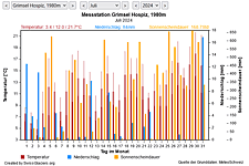
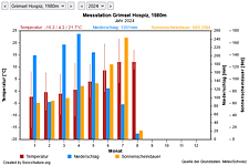
The meteorological/climate data from the MeteoSwiss measuring stations closest to the Kanderfirn have been available since December 2023. You can call up the daily and monthly values for temperature (incl. min/max values), precipitation and sunshine duration, a comparison with the climate standard values and exceptional weather events. Links to the nearest snow depth measuring stations on the Kanderfirn round off the offer.
H Habitats
Discover which plants and animals thrive and live on the Kanderfirn.
B Background information and media reports on the Kanderfirn
The image comparisons of this page were created with the software
Before/After images.